53,210 public comments were submitted(mostly critical) in response to FAA-2019-1100 notice of proposed rule making on Remote Identification of Unmanned Aircraft Systems. In the NOISE three fundamental points got drowned out. I wanted to highlight that today.
Irrespective of which side of the camp you are in, lets first begin by appreciating FAA for at-least raising a flag for people to shoot at unlike some countries who have blanket clamped drone flights which is killing the industry. This is an essential part of public consensus building. For non practitioners and the untrained eye, a-drone-flight-is-a-drone-flight-is-a-drone-flight irrespective of where its flown and therein lies the problem. There are three elements to ponder.
1. The Location? – We ought to make a clear distinction on airspace over factories, farms, Vineyards, quarries, mines etc. These are controlled and secure spaces where public is not allowed to wander. Anyone in there is a worker trained to have complete spatial awareness of any associated dangers prevelant and even required to wear a helmet many times.
2. The Height? – 90% commercial use cases for surveys and inspection have no use flying over 200 ft. Drone delivery is a different animal. Manned aircraft flying in VFR must stay over 500 ft and helicopters over 300ft (in congested areas) and pilots never play games with minimums (see 14 CFR § 135.203 – VFR: Minimum altitudes ). Besides, there is no logical reason why a random aircraft would fly at 300 ft over a chemical plant unless its contacted by the company for some planned work such as AC installation/construction etc. So drones flying at 200 ft or below pose no significant threat.
3. GSM Connectivity? – The current proposal requires constant internet connectivity between drones and a USP to transmit location data. I hardly get 1 bar on my cell phone in my home which is in a residential area in Fremont, California. How is one expected to get perfect cell signal in a farm or a remote mine to transmit location data continuously? According to FCC 2016 Data, 36 percent of rural Americans lack access to mobile broadband connectivity. Expecting a drone to reliably connect to an USP to relay its location in such areas is not tenable. Again, what is the danger in flying at 200 ft in such a remote area?
I believe the rule making debate will benefit if we split the big problem into smaller problems. Two things…
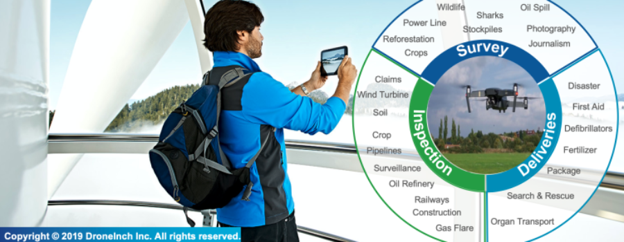
1. Distinguish between Drones for Survey/Inspection versus drones for Deliveries… Majority of use cases(see picture) are in the former bucket.
2. Separate rules for flying over cities/towns/densely populated/public areas versus controlled areas such as farms/mines/vineyards/construction sites/reservoirs/train lines/pipelines etc.
Thoughts … comments? Do you agree/disagree?


Most Commented Posts